


Create digital Orthophoto World View II imagery and high-resolution DEM: monitoring environmental im
- Pittas Andreas
- Nov 5, 2015
- 1 min read

The expansion of surface coal mining to meet the world’s energy needs must include preplanning for environmental protection and the monitoring of reclamation progress.
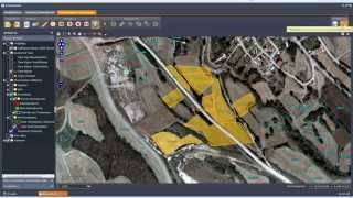
Due to the rapid changes in rates of mining, grading, and revegetating mined lands, the flexibility provided by satellite and multilevel aircraft inventory and monitoring systems is required. World View II imagery and extensive Gis techniques have unique advantages for performing a rapid regional inventory of disturbances in coal-mining areas, and have immediate cost benefits for regulatory agencies and the mining industry.
Large-scale photography is needed for comprehensive studies of mine drainage, and other mining-related water-quality control problems.


![Structure from Motion [SfM] Photogrammetry for Industrial Heritage.](https://img.youtube.com/vi/gHZmoRy9Lks/mqdefault.jpg)


Comments