 Master Plan of the environmental threats of a Hotel construction site - Ikos Odissia Corfu - Greece.The construction of the "Ikos Odissia" Hotel in Corfu, Greece, marks an exciting development for the tourism industry in the region. However, every construction project, regardless of its significance, brings with it a set of environmental threats that must be addressed responsibly. This master plan outlines the key environmental concerns associated with the construction of Ikos Odissia Hotel and provides a comprehensive strategy for mitigating these threats. |  Industrial Heritage Master PlanGuardians of the past, industrial sites testify to the ordeals and exploits of those who worked in them. Industrial sites are important milestones in the history of humanity, marking humanity's dual power of destruction and creation that engenders both nuisances and progress. |  Shaded Relief Mapping |  Gratini Dam - GreeceUnderstanding the impact of dam-triggered land use/land cover change |  Expropriation Orthophoto MapThe dynamics of urban expansion and its impacts on land use/land cover change and small-scale farmers living near mining areas. |  Open Pit Mining LandUse ChangesLand use/land cover changes in the mining area of coal fields of Northern Greece. |
|---|---|---|---|---|---|
 Lignite Center of Western MacedoniaLand use/land cover change dynamics analysis in mining areas of Lignite Center of Western Macedonia - Greece. |  Vereggarria Renovation Project - CyprusDrone Mapping Photogrammetry and Orthophoto produce in Vereggarria abandonent settlement in Cyprus. |  Geological Map of Athos Peninsula |  Lignite Deposits in Megalopoli basin |  Traffic Noise PredictionPrediction, Calculation and Mapping Road Traffic Noise in Asteras Vouliagmeni Bungalows and Resort. |  Pm10 EstimationEstimate PM10 concentration due to a large renovation project in Asteras Hotels and Resort (Vouliagmeni - Greece). |
 Open Pit Mining True Orho MappingGeomatics for Rehabilitation of Mining Area. |  Potentiometric SurfacePotentiometric Surface and Water-Level Difference Maps of Selected Confined Aquifers in Northern Greece. |  Geomorphology MappingTerrain cartography as an essential aspect of physical geography. |  Geologic MappingGeological Web-Gis of Egnatia Motorway |  Hydrolithology MappingCreation of a Digital Aquifer Permeability Map for the Chalkidiki watershed in North Greece. |  Geologic MappingGeologic Mapping for water quality project. The case of Eleftheres watershed. North Greece. |
 Noise EstimationNoise Estimation Mapping due to large Renovations Project. |  Landfill 3D VisualisationIntergrated GIS, Fuzzy Logic and AHP in modelling Optimum Sites for Landfill Selection. |  Watershed Conductivity and SalinityUrban Watersheds: Geology, Contamination, and Sustainable Development |  Hazard Risk MappingIntergrated GIS, Fuzzy Logic and AHP in modelling Optimum Sites for Landfill Selection. |  Geologic MappingHydrothermal alteration zones detection in Limnos Island through remote sensing. |
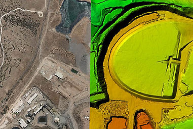
Orthophoto
An orthophoto is an aerial photograph or image geometrically corrected "orthorectified" such that the scale is uniform: the photo has the same lack of distortion as a map. Unlike an uncorrected aerial photograph, an orthophotograph can be used to measure true distances, because it is an accurate representation of the Earth's surface, having been adjusted for topographic relief lens distortion, and camera tilt.
Orthophotographs are commonly used in Geographic Information Systems (GIS) as a "map accurate" background image. An orthorectified image differs from "rubber sheeted" rectifications as the latter may accurately locate a number of points on each image but "stretch" the area between so scale may not be uniform across the image. A digital elevation model (DEM) is required to create an accurate orthophoto as distortions in the image due to the varying distance between the camera/sensor and different points on the ground need to be corrected. An orthoimage and a "rubber sheeted" image can both be said to have been "georeferenced" however the overall accuracy of the rectification varies. Many GIS software can display the orthophoto and allow an operator to digitize or place linework, text annotations or geographic symbols (such as hospitals, schools, and fire stations). Some software can process the orthophoto and produce the linework automatically.

Satellite Orthophoto
Satellite imagery and aerial photographs play an important role in general mapping, as well as GIS data acquisition and visualization. First, they help provide a solid visual effect. Many people are more able to put spatial concepts into perspective when they see photos. In addition, the secondary and perhaps more vital role is to provide a basis for gathering spatial information.
Examples of this are features such as roads, vegetation and water. Before this information can be gathered in a manner that is useful for a mapping or GIS system, the image data must be prepared in a way that removes distortion. This process is called orthorectification. Without this process, you wouldn't be able to make direct and accurate measurements of distances, angles, positions and areas.
Case Study

Uav Orphophoto
Aerial photogrammetry was once the sole purview of full-size manned aircraft with expensive aerial photogrammetric cameras. Now relatively inexpensive and intelligent UAVs that can carry consumer and presumer cameras have changed the access to aerial mapping systems, instead of limiting their use only to large budget projects. Examples of UAV photogrammetry are golf course mapping, large accident scene diagramming, mining documentation and stockpile volume measurement.
Advances in photogrammetry software have made using the images from UAV cameras much easier as well. There are a number of interesting outputs from UAV photogrammetry such as maps and diagrams, contour maps, DTMs, volume measurements, ortho-photos and photo-mosaics.
