 Master Plan of the environmental threats of a Hotel construction site - Ikos Odissia Corfu - Greece.The construction of the "Ikos Odissia" Hotel in Corfu, Greece, marks an exciting development for the tourism industry in the region. However, every construction project, regardless of its significance, brings with it a set of environmental threats that must be addressed responsibly. This master plan outlines the key environmental concerns associated with the construction of Ikos Odissia Hotel and provides a comprehensive strategy for mitigating these threats. |  Industrial Heritage Master PlanGuardians of the past, industrial sites testify to the ordeals and exploits of those who worked in them. Industrial sites are important milestones in the history of humanity, marking humanity's dual power of destruction and creation that engenders both nuisances and progress. |  Shaded Relief Mapping |  Gratini Dam - GreeceUnderstanding the impact of dam-triggered land use/land cover change |  Expropriation Orthophoto MapThe dynamics of urban expansion and its impacts on land use/land cover change and small-scale farmers living near mining areas. |  Open Pit Mining LandUse ChangesLand use/land cover changes in the mining area of coal fields of Northern Greece. |
|---|---|---|---|---|---|
 Lignite Center of Western MacedoniaLand use/land cover change dynamics analysis in mining areas of Lignite Center of Western Macedonia - Greece. |  Vereggarria Renovation Project - CyprusDrone Mapping Photogrammetry and Orthophoto produce in Vereggarria abandonent settlement in Cyprus. |  Geological Map of Athos Peninsula |  Lignite Deposits in Megalopoli basin |  Traffic Noise PredictionPrediction, Calculation and Mapping Road Traffic Noise in Asteras Vouliagmeni Bungalows and Resort. |  Pm10 EstimationEstimate PM10 concentration due to a large renovation project in Asteras Hotels and Resort (Vouliagmeni - Greece). |
 Open Pit Mining True Orho MappingGeomatics for Rehabilitation of Mining Area. |  Potentiometric SurfacePotentiometric Surface and Water-Level Difference Maps of Selected Confined Aquifers in Northern Greece. |  Geomorphology MappingTerrain cartography as an essential aspect of physical geography. |  Geologic MappingGeological Web-Gis of Egnatia Motorway |  Hydrolithology MappingCreation of a Digital Aquifer Permeability Map for the Chalkidiki watershed in North Greece. |  Geologic MappingGeologic Mapping for water quality project. The case of Eleftheres watershed. North Greece. |
 Noise EstimationNoise Estimation Mapping due to large Renovations Project. |  Landfill 3D VisualisationIntergrated GIS, Fuzzy Logic and AHP in modelling Optimum Sites for Landfill Selection. |  Watershed Conductivity and SalinityUrban Watersheds: Geology, Contamination, and Sustainable Development |  Hazard Risk MappingIntergrated GIS, Fuzzy Logic and AHP in modelling Optimum Sites for Landfill Selection. |  Geologic MappingHydrothermal alteration zones detection in Limnos Island through remote sensing. |
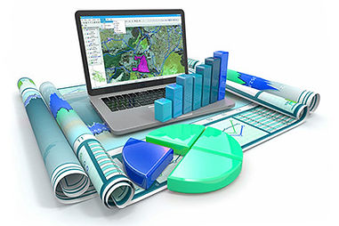
Geospatial cloud
Data semantics play an extremely significant role in spatial data infrastructures by providing semantic specifications to geospatial data and enabling in this way data sharing and interoperability. By applying, on the fly, composite geospatial processes on the above data it is possible to produce valuable geoinformation over the web directly available and applicable to a wide range of geo-activities of significant importance for the research and industry community.
Cloud computing may enable geospatial processing since it refers to, among other things, efficient computing resources providing on demand processing services. In this context, we attempt to provide a design and architectural framework for web applications based on open geospatial standards.
Our approach includes, in addition to geospatial processing, data acquisition services that are essential especially when dealing with satellite images and applications in the area of remote sensing and similar fields. As a result, by putting in a common framework all data and geoprocesses available in the Cloud, it is possible to combine the appropriate services in order to produce a solution for a specific need.

Benefits
Regardless of the industry there are strengths to using a cloud-based service. This may particularly be the case for GIS because of the potentially complex software tools and large datasets.
-
Hardware cost efficiencies - This is perhaps the largest cost-savings. There is no need to procure the hardware infrastructure required to run the enterprise GIS. Also there are no maintenance costs.
-
Scalability - The cloud infrastructure can be scaled to meet demand. This is a benefit if the consumption of the GIS maps, data, and web services fluctuate.
-
Ease of use - Administering a cloud GIS is often very easy, giving the operator a simple-tounderstand user experience/interface.
-
Disaster recovery and availability - The cloud provider should meet certain up-time requirements and should have various physical locations for infrastructure in the event of a calamity.

Limitations
While there are numerous benefits to using a cloud-based GIS, one should also be aware of the potential limits.
-
Lack of customization/enhancements - The tools, applications, and functionality of the cloud-based GIS is by-and-large determined by the service provider. Think of it as “GIS for the masses.”
-
Data formats - The format of the data available through the cloud GIS is limited to what the provider delivers.
-
Privacy concerns - Sensitive data or PII (Personally Identifiable Information) may prohibit the information from being stored off-premise (i.e. in the cloud).
Functionality
Evmolpos online applications is a cloud-based mapping platform designed for geosciences. It includes functionality to accomplish tasks in the cloud. These functions can be grouped into “mapping”, “analysis”, and “applications.”
-
Basic mapping functionality is presented when opening the map – zoom in/out, pan, travel directions, measure, bookmarks, and find an address or place, are included. Popups can be configured to display feature attributes.
-
Analyzing data added to the map is performed by clicking on the menu button for that data set. With quarterly is building a useful set of analysis tools that users have at their disposal.
-
Once a web map is authored and shared it can be used to create a web application. This application can reside within Evmolpos online or on the user’s own server.