 Master Plan of the environmental threats of a Hotel construction site - Ikos Odissia Corfu - Greece.The construction of the "Ikos Odissia" Hotel in Corfu, Greece, marks an exciting development for the tourism industry in the region. However, every construction project, regardless of its significance, brings with it a set of environmental threats that must be addressed responsibly. This master plan outlines the key environmental concerns associated with the construction of Ikos Odissia Hotel and provides a comprehensive strategy for mitigating these threats. |  Industrial Heritage Master PlanGuardians of the past, industrial sites testify to the ordeals and exploits of those who worked in them. Industrial sites are important milestones in the history of humanity, marking humanity's dual power of destruction and creation that engenders both nuisances and progress. |  Shaded Relief Mapping |  Gratini Dam - GreeceUnderstanding the impact of dam-triggered land use/land cover change |  Expropriation Orthophoto MapThe dynamics of urban expansion and its impacts on land use/land cover change and small-scale farmers living near mining areas. |  Open Pit Mining LandUse ChangesLand use/land cover changes in the mining area of coal fields of Northern Greece. |
|---|---|---|---|---|---|
 Lignite Center of Western MacedoniaLand use/land cover change dynamics analysis in mining areas of Lignite Center of Western Macedonia - Greece. |  Vereggarria Renovation Project - CyprusDrone Mapping Photogrammetry and Orthophoto produce in Vereggarria abandonent settlement in Cyprus. |  Geological Map of Athos Peninsula |  Lignite Deposits in Megalopoli basin |  Traffic Noise PredictionPrediction, Calculation and Mapping Road Traffic Noise in Asteras Vouliagmeni Bungalows and Resort. |  Pm10 EstimationEstimate PM10 concentration due to a large renovation project in Asteras Hotels and Resort (Vouliagmeni - Greece). |
 Open Pit Mining True Orho MappingGeomatics for Rehabilitation of Mining Area. |  Potentiometric SurfacePotentiometric Surface and Water-Level Difference Maps of Selected Confined Aquifers in Northern Greece. |  Geomorphology MappingTerrain cartography as an essential aspect of physical geography. |  Geologic MappingGeological Web-Gis of Egnatia Motorway |  Hydrolithology MappingCreation of a Digital Aquifer Permeability Map for the Chalkidiki watershed in North Greece. |  Geologic MappingGeologic Mapping for water quality project. The case of Eleftheres watershed. North Greece. |
 Noise EstimationNoise Estimation Mapping due to large Renovations Project. |  Landfill 3D VisualisationIntergrated GIS, Fuzzy Logic and AHP in modelling Optimum Sites for Landfill Selection. |  Watershed Conductivity and SalinityUrban Watersheds: Geology, Contamination, and Sustainable Development |  Hazard Risk MappingIntergrated GIS, Fuzzy Logic and AHP in modelling Optimum Sites for Landfill Selection. |  Geologic MappingHydrothermal alteration zones detection in Limnos Island through remote sensing. |
Gis Services
Evmolpos provide a wide range of services in the field of Geographic Information Systems or GIS, helping organisations to better understand and gain benefit from the geographic information at their disposal.
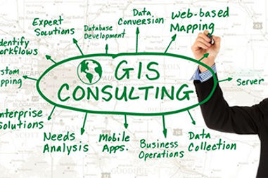
Gis Consultancy
Evmolpos provide independent GIS consultancy services for all sizes and types of organisation. With a highly experienced in-house technical team, we have a strong, established presence in both the Public and Private Sector. We understand the benefits of a bespoke approach to GIS consulting and benefit from being able to advise free from any particular software vendor.
Our range of consultancy services provides:
-
Spatial analysis and map output services
-
Spatial data sourcing, dataset conversion, harmonising and processing
-
Bespoke on-site training in client datasets
-
Off-site support for bottlenecks in GIS projects
-
Development of GIS tools and software coding
-
Scanning, data capture services and geo-referencing services
-
Spatial database design and integration
Gis Software
Evmolpos is an independent consultancy and not tied to any one GIS software vendor.
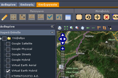
We produces, manage and support a variety of WebGis applications. We use Open Source Platform for publishing spatial data and interactive mapping applications to the web.
Spatial and non-spatial data are stored in the open source RDBMS system PostgreSQL integrating the object-relational database PostGIS, allowing full vector and raster functionality in our WebGIS applications.
Users have the ability to have direct access to their data and manipulating them including editing spatial data geometries.
Evmolpos Web GIS end-user applications run in a simple web-browser such us Chrome, Firefox, Opera, with no other add on needed.
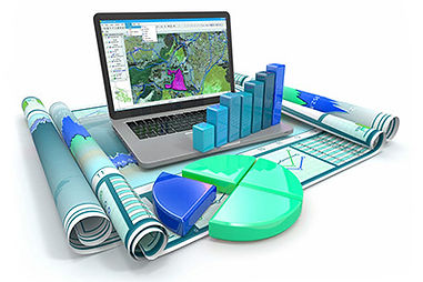
Mapping data
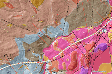
Some of the largest problems, such as climate change, natural disasters, urban planning, geodynamics, population dynamics, are better understood if they are spatially imprinted.
Evmolpos merges spatial data from various sources incorporating with non-spatial data in order to produce accurate maps, allowing the visualization of geographic data patterns and relationships, and finally resulting in better making.
Training and Support
Evmolpos provides training tailored to each client’s specific implementation and business processes. Evmolpos provides onsite and remote training, as well as corresponding user manuals geared for industry specific workflows utilizing the following technologies:
Web Gis
-
Web Viewers (JavaScript, Flex, Silverlight)
-
User Management
-
Mobile Deployment (iOS, Android, ArcGIS Mobile)
Desktop Gis
-
Viewing
-
Editing
-
Cartography
-
Geodatabase Management